|
Many years ago, in the mists of time, the lane adjacent to the boundary of Ash Parish and the detached portion of Worplesdon Parish called "Wyke", was known as Nightingale Lane. Today, the lower section of that lane is known as Harpers Road and the upper section as Nightingale Road, kept separated by the A323; the Guildford - Aldershot Road.
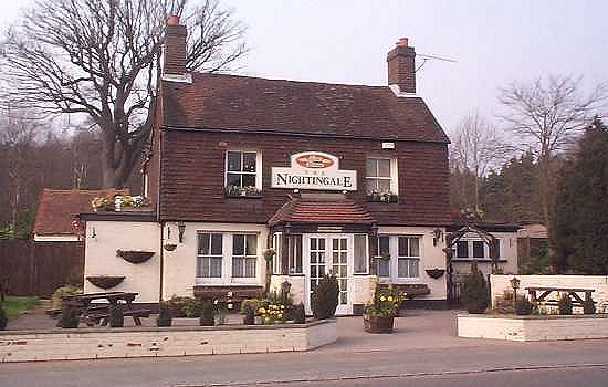
Harpers Road still retains some of the original features, but the construction of the Redhill to Reading railway line in 1848, altered the course of the southernmost end of the lane. The upper section (Nightingale Road), however, remains true to the gravel strewn rivulet that it always was and since 1955, has been the civic boundary between the parishes of Ash and Normandy. Located at the present junction of Nightingale Road with the A323 is "The Indian Summer" restaurant, converted from the former "The Nightingale" public house, which was for over a century both a landmark and a house of sustenance to the local community and passing trade. Originally, the pub was no more than a small cottage with an adjoining pig sty but when the then occupier started brewing beer it soon became known as "The Little Elm Beer Shop". For the benefit of the reader in this instance, "Wyke" as a community, can best be described to include the small farms and scattered cottages of Folly Hatch Lane, Wyke Lane, Pound Lane and Harpers Road, edged by the southern slopes of what is now known as the Ash Ranges. The name "Little Elm", however was the locally given name to that small area of Wyke restricted to the narrow margins of the present A323 from Nightingale Road to the bottom of Elm Hill at its junction with the Pirbright Road and the now defunct Folly Hatch Lane. With the advent of St Mark's Church Wyke (1847) and Wyke School (1874), the centre of gravity of Wyke moved eastwards. Returning to the story of Nightingale Lane (so called), one could be forgiven for thinking that the name was generated by the sweet melodic sounds of the birdsong of that specie of bird - not so! Local folklore suggests that the lane was named after a cow named "Nightingale"! In 1593, John Wheeler, a husbandman of Ash was taken mortally sick and as was the custom of the period, hastily wrote his Will bequeathing his most prized possession to his son William - that being "his most handsome beaste, Nightingale the cow". One must assume that this fine bovine did not possess the voice of the Nightingale but perhaps her colouring resembled the bird? A possibility could be that "Nightingale", the cow, grazed in a pasture adjacent the lane, which in common usage referral became "Nightingale's Lane". The naming of many country lanes is derived from common referral to the name of a farm, the farmer or its long term tenant, so why not a cow? Anyway, rest in peace "Nightingale". I rest my case! It was not until the late 19th century that the southern part of Nightingale Lane became "Harpers Road", possibly contemporaneous with the upgrading of the Aldershot - Guildford Road, and once again with common usage referral to the Harper family. George Harper (c.1757 - 1840), a Corporal of the 56th Regiment of Foot, inherited a cottage at the southernmost part of the lane close to Ash Green Road that is extant but now divided into two. The family must have been held in some esteem for the family name lives on, not just in the naming of the road but also in nearby "Harpers Recreation Ground" formerly "Harpers Allotments". For "The Anoraks", the Surrey County Council classification for Harpers Road is D67. There is so much to be gained from historical research!
|

